Green and Blue Spaces
Green and Blue Spaces

On 16 June 1963, then-Prime Minister Lee Kuan Yew planted a pink mempat tree at Holland Circus. It was the first step of a plan that would eventually see Singapore blossom into a ‘Garden City’.

Transforming Singapore into a ‘garden city’ was important for many reasons. For one, trees and other greenery keep the country free of pollution. Moreover, it was part of Singapore’s attempt to establish itself as a clean and green country to reflect our good governance and attract foreign investors. Greening efforts were thus accompanied by campaigns such as the ‘Keep Singapore Clean’ and ‘Tree Planting Day’.
Today, green spaces continued to reduce air pollution and urban heat, and provide a respite for urban dwellers surrounded by concrete and glass buildings. Today, Singapore has the world’s highest urban tree density, with two million trees lining the streets, and they benefit our living environments in countless ways.
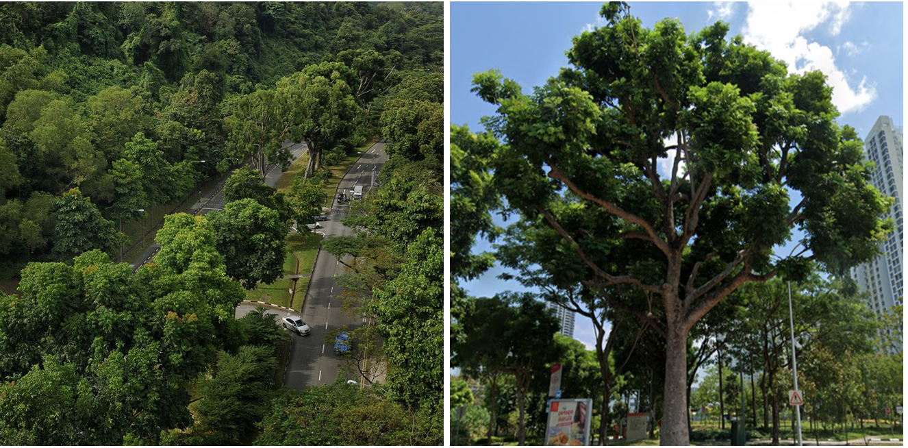 Images: NParks See more at NParks’ Tree Microsite
Apart from green spaces, we have also made concerted efforts to turn our waterways blue and clear. As the late-MM Lee Kuan Yew mentioned in his book, ‘From Third World to First: The Singapore Story, 1965-2000’, one of the key reasons for cleaning up Singapore was to allow us to collect as much of our rainfall (95 inches per year) as possible. Thus, in the 1960s and 1970s, the Government made sure that all sewage from homes and factories emptied into the sewers. Only clean rainwater run-off was allowed into open drains that led into the rivers, which could in turn be used as drinking water. This eventually enabled Singapore to provide 63 million gallons of water per day by 1980 – about half of our daily water needs.
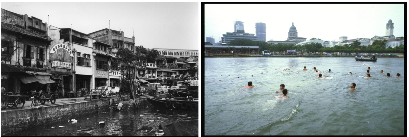 Images: Singapore River before clean-up / first mass swim in the river / PSD
Between 1977 and 1987, the Government embarked on an ambitious clean-up of the then-heavily polluted Singapore River and Kallang Basin. On one hand, it was a massive engineering job that required laying underground sewers across the whole island. On the other, it also required relocating squatters which were a significant source of sewage discharge into the rivers, phasing out pig farms as pig waste were heavily pollutants, and moved people from around 3,000 backyard and cottage industries into industrial estates, where there was proper infrastructure to manage waste. Even with compensation, many were resistant to change.
Despite the discontent, the Government pressed on. The riverbeds were dredged to remove the toxic debris and sediment, while rubbish along the banks was removed. The efforts eventually paid off. By 1987, the Singapore River was transformed into a bustling waterfront area with shops and restaurants opening along the riverbanks.
It was one of the earliest examples of how waterways could enhance the urban landscape. In the past, Singapore’s bare concrete canals only served to prevent floods. However, in the 1990s, the Government also began exploring ways they could be used to beautify Singapore.
 Images: Singapore Drainage Planning / PUB
The Active, Beautiful, Clean Waters (ABC Waters) programme has been key to this ongoing effort. Through this programme, the Government looked to create scenic waterfront spaces for public recreational use. Unused spaces on the drainage reserves are transformed into attractive promenades, equipped with amenities.
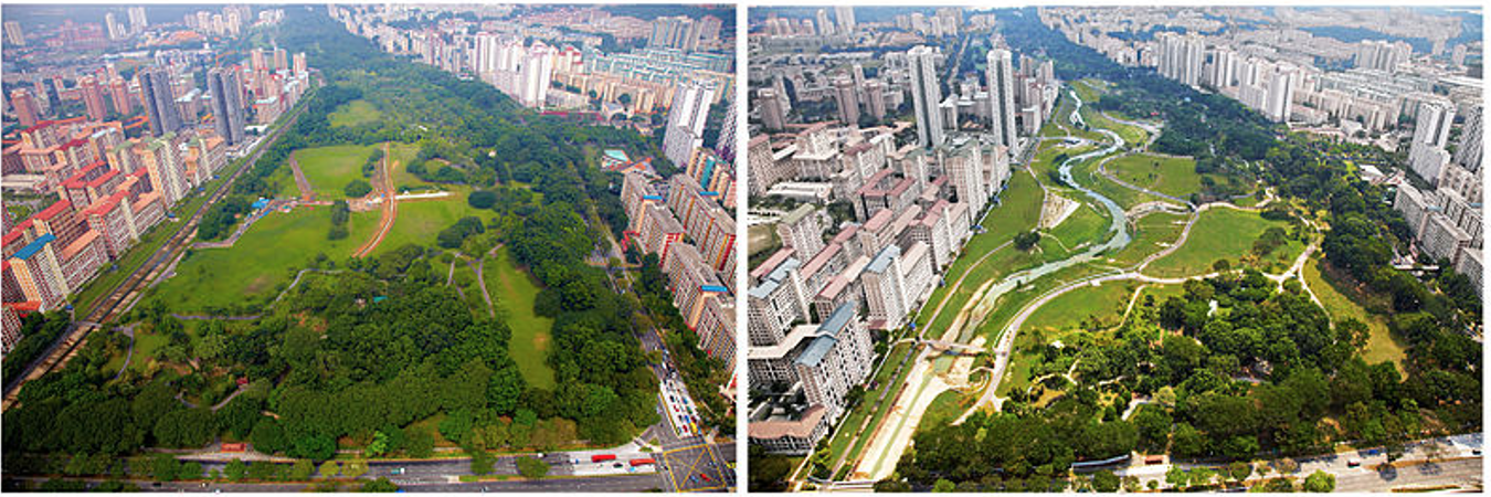 Image: Before and After Aerial View of Kallang River / Wikipedia Commons
The Kallang River @ Bishan-Ang Mo Kio Park is the programme’s flagship project. Before 2009, it was just a 2.7km-long and empty concrete canal adjacent to the park. Under the ABC Waters programme, however, this waterway has transformed into a river. This has created opportunities for new lifestyle activities, and migratory birds and aquatic animals are often spotted there. The river is also designed to prevent floods, the greenery around it acts as a filter to eliminate pollutants in rainwater.
As then-Minister of National Development Lawrence Wong said, “We started out to be a Garden City. Now we’re making Singapore a City of Garden and Waters.”
Yet, Singapore always has to negotiate the balance between greenery and preserving biodiversity, with urban development. For instance, we have overcome some land limitations by building vertical gardens. In 2009, the NParks launched its Skyrise Greenery Initiative, which saw roof gardens on buildings. This has since become an essential component of Singapore’s greening strategy, and we aim to eventually have over 200ha of skyrise greenery across the island.
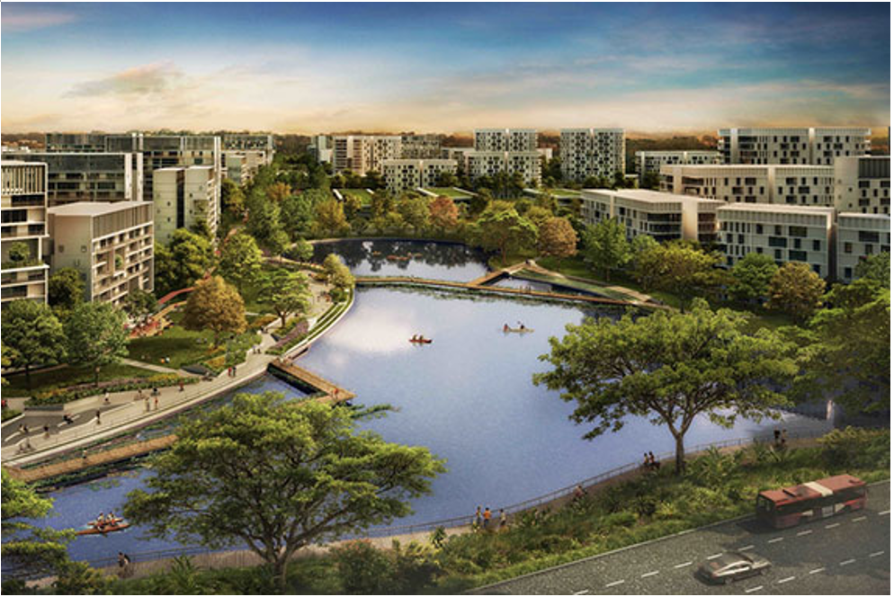 Image: Artist Impression of Tengah HDB Estate / HDB
This balancing act can also be seen in our management of nature reserves as well. Singapore has safeguarded 7,800ha of land as nature reserves, areas, and parks, as well as green spaces such as parks and park connectors. However, our limited land and physical constraints mean that we have had to develop some green areas into urban spaces.

For instance, the 30-hectare Lentor Forest was cleared for private housing in 2016. The construction of Tengah – Singapore’s newest town – also required about 90 per cent of the original forest in the area to be removed. In light of these developments, the public increasingly called for the need to preserve the country’s natural greenery.
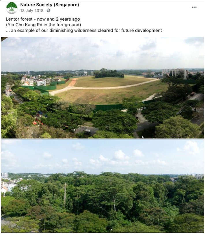 Image: Lentor Forest / Nature Society Facebook Page
When it came to the 33-hectare Dover Forest, which had been slated to be cleared for housing projects, the government launched a public consultation exercise at the start of 2021. It asked for the public to share its feedback, and many spoke spoken out against the zoning of Dover Forest and asked for it to be preserved. The forest is home to at least 158 animal species, including critically endangered ones, and 120 plant species. Nature Society (Singapore), for instance, raised concerns about the loss of biodiversity and wildlife connectivity with other green spaces in the vicinity, such as Clementi Forest. MND and HDB said that it would take the feedback into account.
 Images: Dover Forest / Dover Forest Resource Site
What is key is that the answers to our urban development questions and the outcomes we arrive at are never straightforward. Minister for National Development Desmond Lee said that Singapore will need to continue balancing the needs of development and conservation as part of the long-term planning process. Two ways of doing so are to minimise and mitigate environmental impacts, as well as incorporate nature into urban developments where possible. For example, housing developments in Tengah complement the natural environment by retaining as much of the existing topography as possible. This improves the balance between maintaining natural areas and meeting development needs.
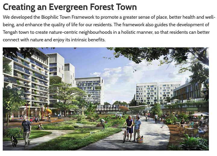 Image: HDB
Singapore has also retained ecologically important green spaces that were initially set aside for other purposes. For instance, Mandai Mangrove and Mudflat was initially designated for industrial use. However, it was eventually retained after biodiversity surveys and ecological modelling were conducted, and will open as a nature park in 2022.
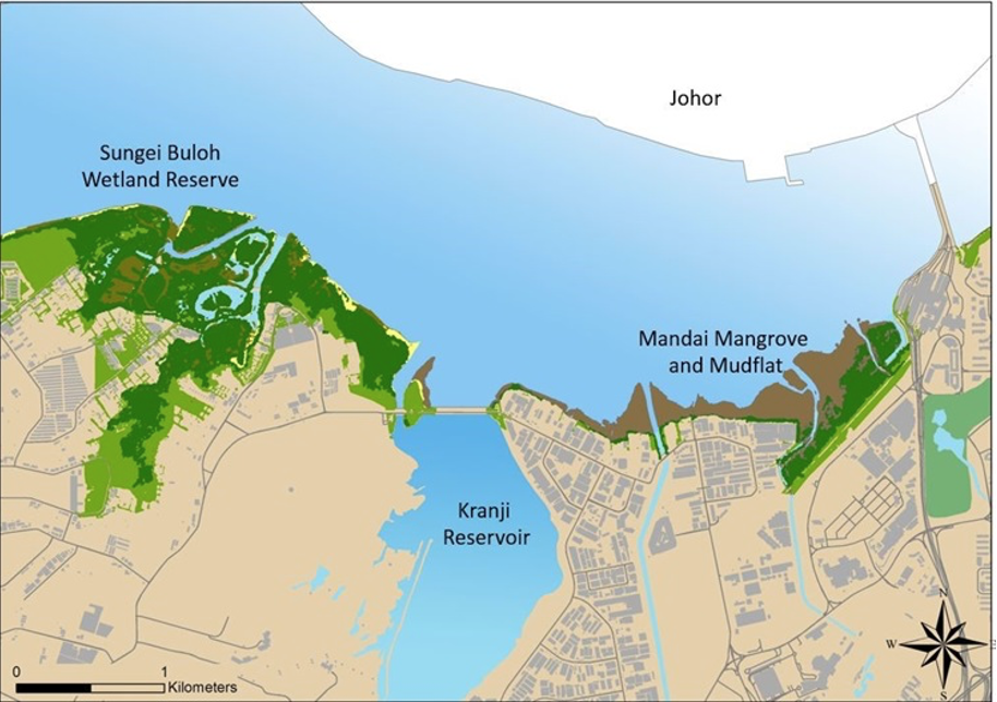 Image: Mandai Mangrove and Mudflat / NParks

